
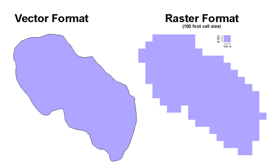
The following shapes represent the same lake. The raster format is created by taking the vector version and converting it into 100 foot cell sizes. Raster format is easier for analysis and computation.


The following shapes represent the same lake. The raster format is created by taking the vector version and converting it into 100 foot cell sizes. Raster format is easier for analysis and computation.
|
|
|