The first step in the Critical Lands Analysis is to assemble the appropriate Resource Elements for each of the Resource Themes. Each element is converted into raster format with a 100 foot cell size. Elements are then overlaid and summed to produce the sum of resources theme. In the example below the resource elements groundwater aquifers, groundwater recharge areas, and wellhead protection areas are overlaid to form Groundwater Sum.
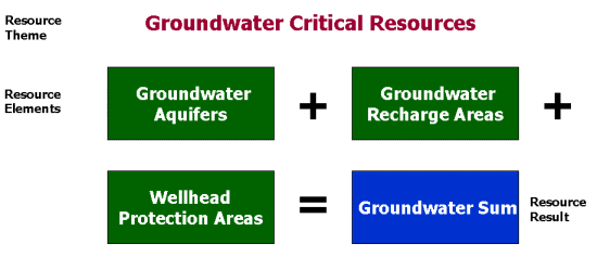
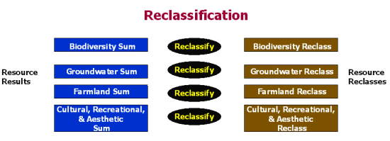
The result, Groundwater Sum has values ranging from 0 (no elements present) to 3 (all three elements present). Groundwater Sum is then reclassified into a presence/absence format where values 1 through 3 become a 1 (resource present) and values of 0 remain 0 (resource not present). This process is repeated for all Resource Themes.
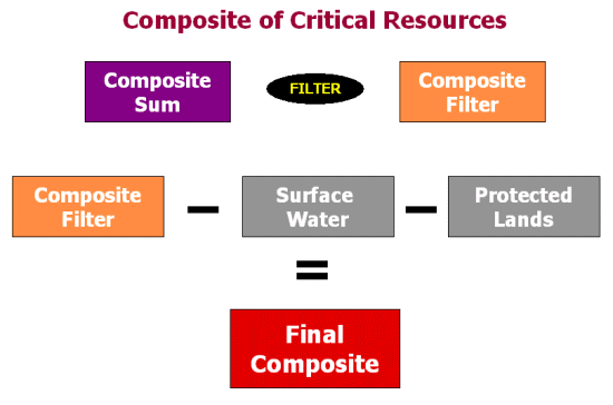
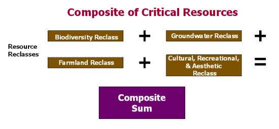
Reclassified Themes are then overlaid and summed to produce the Composite Sum for the entire town. The result, Composite Sum has values ranging from 0 (no resources present) to 4 (all resources present).
The Composite Sum is then filtered using a 3 x 3 pixel average. Every pixel's new value is computed by taking the average of pixels within a 3 pixel radius. This process increases or decreases the value of a pixel based on the values of its neighbors. It also smoothens the final map. See an example.After the filtering process areas that are already protected (Audubon, TNC, USFWS, and DEM lands) and surface water are removed from the Composite Filter to create the Final Composite.